Your shopping cart is empty!
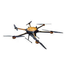
UAV Fluorescence Imaging Oil Pollution Remote Sensing System ATE5000


Availability: In Stock
UAV Fluorescence Imaging Oil Pollution Remote Sensing System ATE5000
Download Data Sheet
Product Code: ATE5000
application
What are the advantages of choosing the UAV Fluorescence Imaging Oil Pollution Remote Sensing System ATE5000?
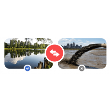
The significant impact of oil spills on Marine ecosystems has attracted worldwide attention.Offshore drilling platforms and ship accidents are the main source of oil spills.
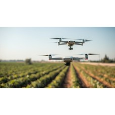
ATE5000 UAV fluorescence imaging oil pollution remote sensing system is a new generation of oil pollution remote sensing detector launched by Optosky.ATE5000 using the world’s most advanced high-frequency modulation Laser-Induced Fluorescence high-speed imaging remote technology.It provides a new and more powerful technique for environmental monitoring to study water pollution by studying the fluorescence characteristics of algae and oil spills.Laser-induced fluorescence method uses specific spectral characteristics to provide identification of different types of release effects of oil and weathering.
The ATE5000 has fast scanning speed and long flight time.
- Principle of remote sensing detection
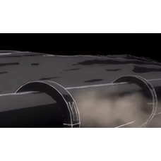
ATE5000 adopts the ultraviolet fluorescence oil measurement method, which is one of the standard methods of oil measurement in the environmental protection field. It uses ultraviolet light of a specific wavelength to irradiate oils on the water surface, and polycyclic aromatic hydrocarbons in the oils absorb them. After being excited, the fluorescence of a specific wavelength is generated, and the intensity of the fluorescence is directly proportional to the intensity of excitation light and the amount of substance to be measured.Therefore, according to the fluorescent effect of this oil substance, it is possible to detect oil pollution on the surface.This method is especially applicable to mineral oils, which are heavier components.Oil, for example, works better;It is sensitive enough to detect sub-ppm level(ppm:the solute mass accounts for one million parts of the total solution mass),it is one of the most common methods to detect oil on water surface because of less interference factors.
ATE5000 UAV fluorescence imaging oil pollution remote sensing system,the laser and spectral analysis system are loaded into the UAV,and the laser is fired from the air to illuminate the oil pollution on the water surface(sea surface,river surface).After absorbing ultraviolet light, the oil pollution on the water surface will emit fluorescence of specific wavelength.The fluorescence signal collected by the UAV can be analyzed to obtain oil pollution on the water surface.
| Optosky Physical Parameters | |
| Dimension | 152mm*143mm*115mm |
| Measuring host | |
| Measurement object | petroleum, motor oil, diesel oil, gasoline, kerosene, etc |
| Measure oil film thickness | The thickness of 1 um can be measured |
| Max endurance flight | 1.5 hours |
| Scanning area | 1-20km^2 |
| Single measurement area | Round, 10 mm in diameter |
| GPS positioning accuracy | 1m |
| Working time | Work day and night |
| Remote control distance | 10 Km |
| Data transfer download distance | 1 Km |
| Environmental requirements | -5—45℃;Relative humidity<90%,No condensation |
| Data transfer download speed | 1Mbps/s |
| The UAV’s own weight | 6 Kg |
What are the major features of the UAV Fluorescence Imaging Oil Pollution Remote Sensing System ATE5000?
Features
▲High accuracy, fluorescence is the fingerprint spectrum of material, there will be a spill of oil fluorescence, will not misjudge.
▲High frequency modulation fluorescence, high speed imaging.
▲Long flight time, up to 1.5 hours.
▲Flying altitude,about 50 meters.
▲Scanning area:1-20![]()
▲Can work during the day and night without interference from background light such as sunlight.
▲High precision GPS navigation planning.
▲Wireless data transmission.
▲transfer download and display measurement data in real-time.
Measuring host | |
Measurement object | petroleum, motor oil, diesel oil, gasoline, kerosene, etc |
Measuring principle | Laser induced fluorescence technique(LIF) |
Measure oil film thickness | The thickness of 1 um can be measured |
Maximum endurance flight | 1.5 hours |
Scanning area | 1-20 |
Single measurement area | Round, 10 mm in diameter |
GPS positioning accuracy | 1m |
Working time | Work day and night |
Remote control distance | 10 Km |
Data transfer download distance | 1 Km |
Data transfer download speed | 1Mbps/s |
Environmental requirements | -5—45℃;Relative humidity<90%,No condensation |
size | 152mm*143mm*115mm |
Load weight | 1.5 Kg |
The UAV’s own weight | 6 Kg |
What are the applications of the UAV Fluorescence Imaging Oil Pollution Remote Sensing System ATE5000?
Applications
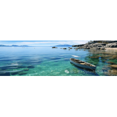
▲Remote sensing of oil spills in rivers and lakes
▲Remote sensing of oil spills in the ocean
▲Chlorophyll remote sensing detection in rivers and lakes
Model | Explanation | Advantage |
ATE5000-DXY | With a 6-rotor UAV, the flight time is up to 1.5 hours and the scanning area is 1-20 square kilometers | |
ATE5000-GDY | With fixed wings, the flight time can be up to three hours and the scanning area can be 5-500 square kilometers | Long endurance and large scanning area |