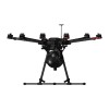
Soil Pollution Monitoring Based on UAV Hyperspectral Imaging
This blog post discusses the use of UAV-based hyperspectral imaging technology for monitoring soil pollution, particularly focusing on heavy metal contamination. It explains how hyperspectral remote sensing leverages the unique spectral fingerprints of elements and compounds to identify and analyze soil properties. The study highlights the use of the Optosky ATH9010 system to collect hyperspectral data and develop models for assessing heavy metal distribution in soils, providing a more efficient and real-time alternative to traditional soil monitoring methods.
The Earth contains a variety of elements and their compounds, each displaying unique spectral characteristics due to differences in their composition, structure, and arrangement. Each element and compound produces distinct absorption and reflection properties within specific wavelength ranges, forming their "spectral fingerprints." Hyperspectral remote sensing technology leverages these spectral features to identify surface objects by analyzing the shape of spectral curves. This technology uses imaging spectrometers to capture radiative information of the surface across dozens or even hundreds of continuous spectral bands. This approach not only provides spatial images of the surface but also generates continuous spectral curves containing diagnostic spectral features for each pixel. In other words, hyperspectral remote sensing technology can identify surface materials such as soil, vegetation, or water, and delve into the internal composition and properties of these materials. For instance, when scanning the surface, this technology can not only identify the covered area of soil but also analyze its components, such as moisture content, organic matter content, or heavy metal pollution..jpg)
Using UAV-based hyperspectral imaging technology to acquire the spectral response characteristics of soil heavy metals, and combining these with measured soil heavy metal values, a model for inverting soil heavy metal content is constructed. This model is used to explore the distribution of soil heavy metal content within the study area. Compared to traditional soil heavy metal monitoring methods, this approach enables real-time and rapid monitoring of soil heavy metal pollution, achieving quick surveys of soil conditions over large areas..jpg)
In this study, Optosky ATH9010 was used to collect hyperspectral data. Field sampling provided 30 soil samples from the plow layer. Adaptive reweighted sampling techniques were employed to select wavelengths with large absolute values of regression coefficients in the Partial Least Squares (PLS) model and to remove wavelengths with smaller weights. Based on the filtered results, inversion models were established using methods such as MLPR, SVM, and RF, and model accuracy was evaluated. The inversion results were used to assess the heavy metal pollution in the study area.
.jpg)
Using UAV-based hyperspectral imaging technology to acquire the spectral response characteristics of soil heavy metals, and combining these with measured soil heavy metal values, a model for inverting soil heavy metal content is constructed. This model is used to explore the distribution of soil heavy metal content within the study area. Compared to traditional soil heavy metal monitoring methods, this approach enables real-time and rapid monitoring of soil heavy metal pollution, achieving quick surveys of soil conditions over large areas.
.jpg)
In this study, Optosky ATH9010 was used to collect hyperspectral data. Field sampling provided 30 soil samples from the plow layer. Adaptive reweighted sampling techniques were employed to select wavelengths with large absolute values of regression coefficients in the Partial Least Squares (PLS) model and to remove wavelengths with smaller weights. Based on the filtered results, inversion models were established using methods such as MLPR, SVM, and RF, and model accuracy was evaluated. The inversion results were used to assess the heavy metal pollution in the study area.
Search
Categories
Popular Posts
Latest Posts

-1000x400.jpg)


-75x75.jpg)


Comments: 0
No comments