Your shopping cart is empty!
UAV 6-Band Multispectral Imager
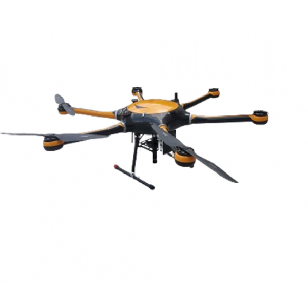
The ATH9606 UAV 6-band multispectral imager, developed by Optosky, represents the latest third-generation technology in compact, lightweight drone-mounted imaging systems. This advanced system integrates a high-stability hexacopter drone, precision gimbal, hyperspectral imager, large-capacity storage, wireless imaging, GPS navigation, ground receiving workstation, and control system.
Availability: In Stock
UAV 6-Band Multispectral Imager
Product Code: ATH9606
application
Description
The ATH9606 UAV 6-band multispectral imager, developed by Optosky, represents the latest third-generation technology in compact, lightweight drone-mounted imaging systems. This advanced system integrates a high-stability hexacopter drone, precision gimbal, hyperspectral imager, large-capacity storage, wireless imaging, GPS navigation, ground receiving workstation, and control system.
This UAV 6-band multispectral imager excels in real-time spectral measurement of vegetation, water bodies, soil, and other land features. By capturing detailed spectral images, it enables in-depth analysis to correlate with the physical and chemical properties of plants and other objects. This capability is crucial for plant classification, growth monitoring, and environmental research.With its compact design and high imaging accuracy, the ATH9606 offers versatile applications. It can function independently with outdoor rotating platforms and indoor linear scanning setups, or be mounted on a drone for aerial remote sensing. This flexibility makes it ideal for industries such as agriculture, environmental monitoring, and land management. The ATH9606 UAV 6-band multispectral imager is at the forefront of technical trends, providing high-performance solutions for precise spectral analysis and enhanced remote sensing capabilities.
Features
- Channels: 6 multispectral
- FOV: 48° × 36.8°
- Resolution: 4096 x 3000
- Filter: Strip
- Altitude: 50~1000m (recommended 100m)
- Computer: I7, up to 2TB storage, 100 hours data
- Drone: 1.5m wheelbase, high payload, expandable
- Flight Time: ~45 minutes
ATHL9606 | |
Flight system | |
Flying platform | Customized version for long time and high load capacity6rotor drone |
PTZ | Three-axis brushless DC motor high stability gimbal |
Number of rotors | 6 |
Take-off and landing mode | vertical takeoff and landing |
Wheelbase | 1500mm |
Maximum load | 6kg |
Maximum ceiling | 5000m |
Drone size | 1650 x 1410 x 500mm |
GPSpositioning accuracy | 1.5m |
Modify imaging parameters remotely | no |
Endurance flight time | >45minute |
Ground station working distance | 5 km |
6-band Multispectral Imager | |
Aisle | 6 |
Resolution | 4096×3000 |
Detector native resolution | 4096 x 3000 |
Detector original pixel size | 3.45 μm x 3.45 μm |
Field of view | 48°×36.8° |
Bit depth | 12 bit |
Center wavelength of each channel | blue:450nm (bandwidth:35nm) |
green:555nm(bandwidth:27nm) | |
red:660nm (bandwidth:22nm) | |
red:720nm (bandwidth:10nm) | |
Red edge:750nm (bandwidth:10nm) | |
Near infrared:840nm (bandwidth:30nm) | |
Frame rate | 31fps |
Data output interface | USB 3.0, |
Detector power supply | USBpowered by3.6 W |
Volume | 8.2 x 6.7 x 6.45cm |
Weight | <580g |
Operating temperature | -20~50°C |
Storage temperature | -20~50°C |
Reliability | |
Range of working temperature | -10~45℃ |
Storage temperature range | -20~65℃ |
Working humidity range | ≤85%RH |


