Your shopping cart is empty!
UAV Water Quality Monitor


Availability: In Stock
UAV Water Quality Monitor
Product Code: ATH9010WT
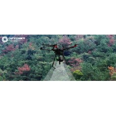
application
Description
The ATH9010WT UAV-borne hyperspectral imaging river water quality inspection system is a UAV remote sensing monitoring product launched by Optosky for application fields such as rivers, lakes, oceans, and water sources that need to monitor water quality. ATH9010WT is a brand-new product that combines the functions of large-scale hyperspectral water quality monitoring, on-site video evidence collection, and on-site water collection (optional).
ATH9010WT adopts the world's leading hyperspectral water quality remote sensing technology. It has a built-in high-performance hyperspectral analyzer developed and produced by Optosky. It has invested a lot of money in conjunction with the Chinese Academy of Sciences to jointly develop and train a deep learning inversion algorithm, and has experienced tens of thousands of on-site water quality tests. Sample experiments were carried out to successfully develop a multi-parameter real-time detector for water quality.
ATH9010WT can provide in-situ multi-parameter water quality parameters in real time, promptly alarm for abnormal conditions, and record on-site visible light videos/pictures.
Features
- Parameters : chlorophyll, total phosphorus, total nitrogen, total suspended solids;
- The distribution pseudo-color map is directly formed, which is intuitive and clear.
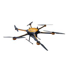
- Vertical takeoff and landing drone or multi-rotor drone
- Maximum patrol distance: 200 kilometers
- Maximum river width: 2 Km
- Maximum flight altitude: 5 Km
- Maximum band range: 400~1000nm
- Maximum number of spatial bands: 2048
- Maximum number of spectral bands: 1088
- Compact size and light weight: <4 Kg (different for each model);
- Built-in calibration spectrometer for real-time calibration of radiation spectrum
- High-definition visible light camera for image fusion;
- Can add on-site water collection function
NO. | Commodity | Number | Optional |
1 | Hyperspectral imager (400-1000nm) mainframe | 1 unit | Standard |
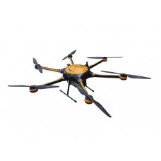
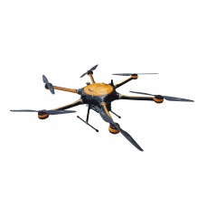
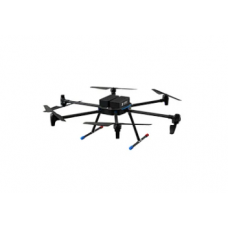
2 | 6 Rotor UAV | 1 unit | Standard |
3 | Highly reliable UAV gimbals and landing gears | 1 unit | Standard |
4 | On-board data acquisition and high-capacity data storage system | 1 set | Standard |
5 | Battery pack | 1 piece | Standard |
6 | Objective lens and radiometric calibration | 1 set | Standard |
7 | Hyperspectral imaging water quality calculation algorithm software | 1 set | Standard |
8 | 50cm diameter 95% field calibration whiteboard | 1 piece | Standard |
9 | High precision indoor scanning head | 1 set | Optional |
10 | High blue steady current halogen lamp | 4 pieces | Optional |
11 | Standard calibration plate | 1 set | Optional |
12 | Original imported field-specific calibration cloth (1.2m×1.2m) | 1 piece | Optional |
13 | 360 degree field rotating platform | 1 piece | Optional |
14 | Tripod | 1 piece | Optional |
15 | Field-specific high-capacity lithium battery | 2 pieces | Optional |
16 | Measurement darkroom | 1 piece | Optional |
17 | Field portable transport case | 1 piece | Optional |
18 | Sweeping device | 1 unit | Optional |