Description
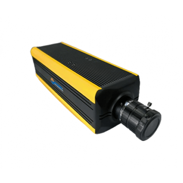
The ATH1080 is a hyperspectral imager specifically designed by Optosky for the mid- to far-infrared spectral bands. In addition to being compact and lightweight, the ATH1080 uses a Stirling-cooled CCD with deep cooling, featuring low dark current, low noise, high spatial resolution, high spectral resolution, and a wide imaging range. The ATH1080 consists of two main components: an imaging lens and a hyperspectral spectrometer. The hyperspectral spectrometer is based on transmission grating technology, which provides excellent aberration characteristics.The ATH1080 utilizes a Stirling deep-cooled high-performance infrared CCD imaging device, offering clear images with minimal noise. The ATH1080 is a conventional straight-tube hyperspectral camera, suitable for multi-rotor camera drones and agriculture drones. For fixed-wing camera drones and other drones with short landing gear, Optosky has developed the specialized ATH1080L model with a bent optical path, reducing the height requirements for landing gear.The ATH1080 can be used for real-time measurement of spectral information from various ground features such as plants, water bodies, and soil, obtaining spectral images. By analyzing these spectral images, relationships can be established with the physical and chemical properties of plants and other features, useful for plant classification, monitoring plant growth conditions, and other research. The entire system is compactly designed, with the main spectrometer unit offering high spectral resolution. It employs an external push-broom imaging method, which can be integrated with field rotary platforms and indoor linear scanning platforms to form independent measurement systems. Additionally, it can be mounted on drones for aerial remote sensing operations, contributing to agricultural production and environmental monitoring.
Features
- Wavelength Range: 2.5~5.0 μm, 7.8~12.3 μm
- Spectral Path: Holographic Transmission Grating
- Ultra-Low-Temperature Stirling-Cooled CCD
- Detector Resolution: 640x512 or 320x256
- Advanced Image Compression Algorithm
- Compact Size: 279 mm × 135 mm × 145 mm
- Lightweight: <4500 g
- No Mechanical Scanning, High Reliability
No. | Specification | ATH1080-MW | ATH1080-LW |
1 | Spectral Range | 2.5~5.0μm | 7.8~12.3μm |
2 | Spectral Resolution (FWHM) | No Binning:<30nm 4X4binning:50nm | No Binning:<50nm 4X4binning:100nm |
3 | Sampling Interval | 8.0 nm | 15.0 nm |
4 | F/# | F/2.6 | F/2.6 |
5 | Sensor | Stirling Cooled MCT CCD | Stirling Cooled MCT CCD |
6 | Data interface | USB3.0 | USB3.0 |
7 | Power Consumption | DC12V,<15 W | DC12V,<15W |
8 | Sensor Size | 9.6 mm × 7.68 mm | 9.6 mm × 7.68 mm |
9 | Sensor Resolution | ATH1080-MW-MCT3:320×256 ATH1080-MW-MCT6:640×512 | ATH1080-LW-MCT3:320×256 ATH1080-LW-MCT6:640×512 |
10 | Pixel Size | ATH1080-MW-MCT3:30μm ATH1080-MW-MCT6:15μm | ATH1080-LW-MCT3:30μm ATH1080-LW-MCT6:15μm |
11 | Bit Depth | 16 bits | 16 bits |
12 | NETD | <20mK | <1K |
13 | Dynamic range | 73 dB | 60 dB |
14 | Slit Width | 30µm、15µm | 30µm、15µm |
15 | Binning Mode | 4×4 / 2×4 | 4×4 / 2×4 |
16 | Max spatial Bands | 256、512 | 256、512 |
17 | Max Spectral Bands | 320、640 | 320、640 |
18 | (FOV) | 12.5°@f=35 mm 17.5°@f=25 mm | 12.5°@f=35 mm 17.5°@f=25 mm |
19 | (IFOV) | 0.017mrad @ f=35 mm 0.0234mrad @f=25 mm | 0.00977mrad@f=35 mm 0.0137mrad@f=25mm |
20 | Max Frame Rate | 150 fps | 120 fps |
21 | Dimensions | 279 mm × 135 mm × 145 mm | 279 mm × 135 mm × 145 mm |
22 | Weight | <3545 g | <3580 g |
23 | Operating Temperature | -20 ~ 50°C | |
24 | Storage Temperature | -30 ~ 70°C | |
Note: The parameters in the table are for reference only; other performance parameters of the instruments can be customized. | |||


