Your shopping cart is empty!
UAV-Borne Lidar System
Availability: In Stock
UAV-Borne Lidar System
Product Code: ATL9000
application
Description
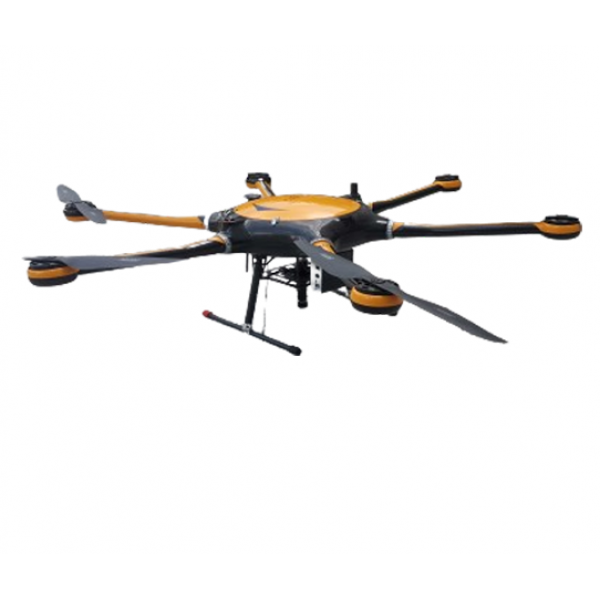
The ATL9000 series UAV-borne Lidar system, launched by Optosky, represents the latest in advanced Lidar technology. This compact and lightweight system comprises a high-stability hexacopter, a stable gimbal, Lidar sensor, high-capacity storage system, GPS navigation system, ground reception workstation, and ground control system. Utilizing line-scan Lidar, it provides accurate elevation data and precise orthorectification of images, while also capturing 3D information on landforms. This integration allows for combined spectral and spatial analysis, offering new research perspectives.The ATL9000 integrates high-resolution solid-state scanning Lidar modules with high-precision inertial navigation, generating true-color point clouds in real-time. A single flight can quickly acquire over 2 km² of point cloud data. The ATL9000 UAV-borne Lidar can measure the height of vegetation, water bodies, and soil in real-time, providing visible light images. Analyzing these images and height data helps establish relationships with the physical and chemical properties of plants, aiding research in plant classification and growth conditions.For industries utilizing UAV-borne Lidar systems, including agriculture and environmental monitoring, the ATL9000 stands out as a cutting-edge tool for data collection and analysis. The technology trend towards high-resolution, real-time Lidar solutions continues to advance, making systems like the ATL9000 integral to modern geospatial applications.
Features
- LiDAR range: 1-300m
- Height error: 20mm
- Flight altitude: 50-1000m (100m recommended)
- Solid-state LiDAR, non-mechanical, reliable
- I7 onboard, 2TB storage, 100 hours data
- 1.5m multi-rotor drone, high payload, expandable
- 45-minute flight time, large area
- Flight management (Partner: China PICC)
Item | ATL9000 | NA | ATL9000W | ||
Flight System | |||||
Flight Platform | Custom large high-load six-rotor drone | ||||
Gimbal | Three-axis brushless motor high-stability gimbal | ||||
Number of Rotors | 6 Rotors | ||||
Takeoff and Landing Method | Vertical Takeoff and Landing | ||||
Wheelbase | 1500 mm | ||||
Max Payload | 6 Kg | ||||
Max Ceiling | 5000 m | ||||
Drone Dimensions | 1650 X 1410 X 500 mm | ||||
GPS Positioning Accuracy | 1.5 m | 0.5 m | <0.3 m, RTK | ||
Remote Imaging Parameter Modification | No | Yes | Yes | ||
Endurance Flight Time | >45 minutes | >45 minutes | >45 minutes | ||
Ground Station Operating Range | 5 Km | 10 Km | 10 Km | ||
Laser Radar | |||||
Radar Working Principle | TOF Time-of-Flight Distance Measurement | ||||
Laser Wavelength | 1550 nm, eye-safe class 1 | ||||
Distance Measurement Speed | 500,000 points/sec, up to 1,000,000 points/sec (depending on distance) | ||||
Number of Scan Lines | 1750 lines | ||||
Field of View Angle | Horizontal 15° | ||||
Angular Resolution | Horizontal 0.009° | ||||
Scanning Frequency | 500 Hz | ||||
Height Measurement Range | 1~300 m, up to 600 m | ||||
Laser Return Mode | Multiple Echoes | ||||
Height Measurement Error | <20 mm | ||||
Weight | 1.5 Kg | ||||
Reliability | |||||
Operating Temperature Range | -10 ~ 45℃ | -20 ~ 65℃ | -20 ~ 65℃ | ||
Storage Temperature Range | -20 ~ 65℃ | -20 ~ 65℃ | -20 ~ 65℃ | ||
Operating Humidity Range | ≤85% RH | ≤85% RH | ≤85% RH | ||
Optical Parameters (Customizable) | |||||
Onboard Data Acquisition System | I7 Processor, 16G RAM, 512GB SSD, upgradeable to 2TB | ||||
Visible Light Camera | |||||
Resolution | 2 Megapixels | ||||
Frame Rate | 20 FPS | ||||


