Your shopping cart is empty!
All-Solid-State Line-Scan Lidar
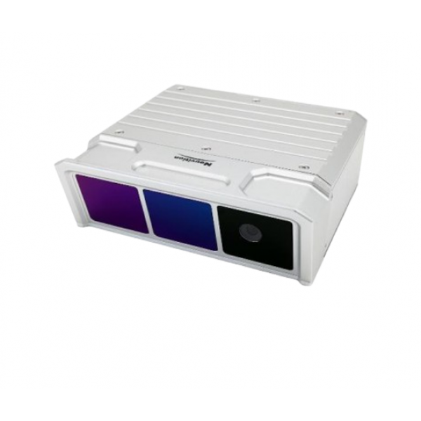
The ATL9100 by Optosky represents the pinnacle of advanced technology in the realm of all-solid-state line-scan Lidar systems. This high-resolution Lidar product is engineered to meet the demands of various applications such as high-speed motion tracking, autonomous vehicle navigation, and real-time 3D mapping. With its remarkable point cloud output refresh rate of up to 500Hz and a fine angular resolution of 0.009°, the ATL9100 excels in delivering precise and effective long-range detection. Its integration of an embedded camera for dual output of both point cloud data and video streams further enhances its versatility.
Availability: In Stock
All-Solid-State Line-Scan Lidar
Product Code: ATL9100
application
Description
The ATL9100 by Optosky represents the pinnacle of advanced technology in the realm of all-solid-state line-scan Lidar systems. This high-resolution Lidar product is engineered to meet the demands of various applications such as high-speed motion tracking, autonomous vehicle navigation, and real-time 3D mapping. With its remarkable point cloud output refresh rate of up to 500Hz and a fine angular resolution of 0.009°, the ATL9100 excels in delivering precise and effective long-range detection. Its integration of an embedded camera for dual output of both point cloud data and video streams further enhances its versatility.
In the field of Lidar technology, the ATL9100 stands out as a cutting-edge solution suitable for diverse applications including rail transit systems, robotics, unmanned aerial vehicles (UAVs), and security surveillance. As a core sensor in embedded artificial intelligence systems, it is at the forefront of technical trends in the Lidar industry. For those seeking high-performance all-solid-state Lidar solutions, the ATL9100 offers an unparalleled combination of resolution, speed, and application flexibility.
Features
- Lidar Measurement Range: 1 To 300 Meters
- Lidar Height Measurement Error: 20 Mm
- Line Resolution: 1750
- Solid-State Lidar, Non-Mechanical Scanning, High Reliability
- Built-In 2-Megapixel High-Definition Camera
- 1550 Nm Eye-Safe Laser Wavelength
- Fast Measurement Speed: Up To 1 Million Points Per Second
Model | ATL9100 |
Lidar | |
Lidar Working Principle | tof (time of flight) distance measurement |
Laser Wavelength | 1550 nm, eye-safe class 1 |
Distance Measurement Speed | 500,000 points/second, up to 1,000,000 points/second (depending on distance) |
Number Of Scan Lines | 1750 lines |
Field Of View | horizontal 15° |
Angular Resolution | horizontal 0.009° |
Scan Frequency | 500 hz |
Height Measurement Range | 1 to 300 m, up to 600 m |
Laser Return Mode | multiple echoes |
Height Measurement Error | <20 mm |
Api Interface | gigabit ethernet interface |
Output | 3d spatial coordinates, video stream data, timestamps, etc. |
Waterproof Rating | ip67 |
Dimensions | 169 mm x 60 mm x 156 mm |
Weight | 1.5 kg |
Reliability | |
Operating Temperature Range | -10 to 45°c |
Storage Temperature Range | -20 to 65°c |
Operating Humidity Range | ≤85% rh |
Visible Light Camera | |
Resolution | 1 megapixel (1280 x 720 (720p)) |
Frame Rate | 20 fps |


