Your shopping cart is empty!
multispectral camera
Availability: In Stock
multispectral camera
Download Data Sheet
Product Code: ATH2603
application
ATH2603 is a handheld 3-channel multispectral imager independently developed by Optosky. Users can select lenses and filters according to application scenarios to meet different usage needs.
ATH2603 is a compact, cost-effective handheld multispectral camera that can be used for ground and aerial drone surveying and mapping. ATH2603 has the characteristics of real-time imaging, high resolution and low noise, so the equipment can be widely used in industries such as surveying and mapping, plant disease detection and meteorological research.
The ATH2603 Multispectral Camera is a new easy-to-use multispectral imager equipped with a high-precision GPS receiver that automatically geotags each image. It has a 12-megapixel sensor that can acquire high-resolution, high-quality data, and has the function of outputting inversion results in real time.
| Multispectral | |
| Center Wavelength of Each Channel | Blue: 450nm ( Bandwidth: 35nm) Green: 555nm (Bandwidth : 27μm ) 15 nm Red: 660nm ( Bandwidth: 22nm) |
| Field of View | 48°×36.8° |
| Lens Focal Length | 8mm |
| Number of Channels | 3 |
| Shutter Speed | 4.98 mm1/2000 to 1min (automatic) |
| Optical parameter | |
| Working temperature | - 20℃ to 50℃ |
| parameter | |
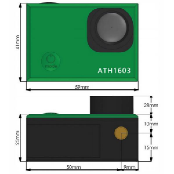
| Dimensions | 820×670×645mm |
| Weight | <150g |
| Electrical parameter | |
| Data output interface | USB3.0 |
| Power supply | USB, 1.5V |
| Resolution | 4000*3000 |
| Storage temperature | -20 ~ 50°C |
- Bracket optional,used with any model of drone.
- The collected data all have geographical information.
- Accurate GPS receiver.
- Large-capacity lithium battery, suitable for field work.
- Autofocus system optional.
- Trigger options: interval/timer and external PWM shooting modes.
- Wide range of applications.
- SWM signals can be used,easily extract images via USB.
- No-mechanical scanning, high reliability.
- Phenotypic analysis
- Crop health mapping
- Water stress analysis
- Leak detection
- Fertilizer management
- Regional mapping
- High altitude flight
- Meteorological research
- Disease identification


